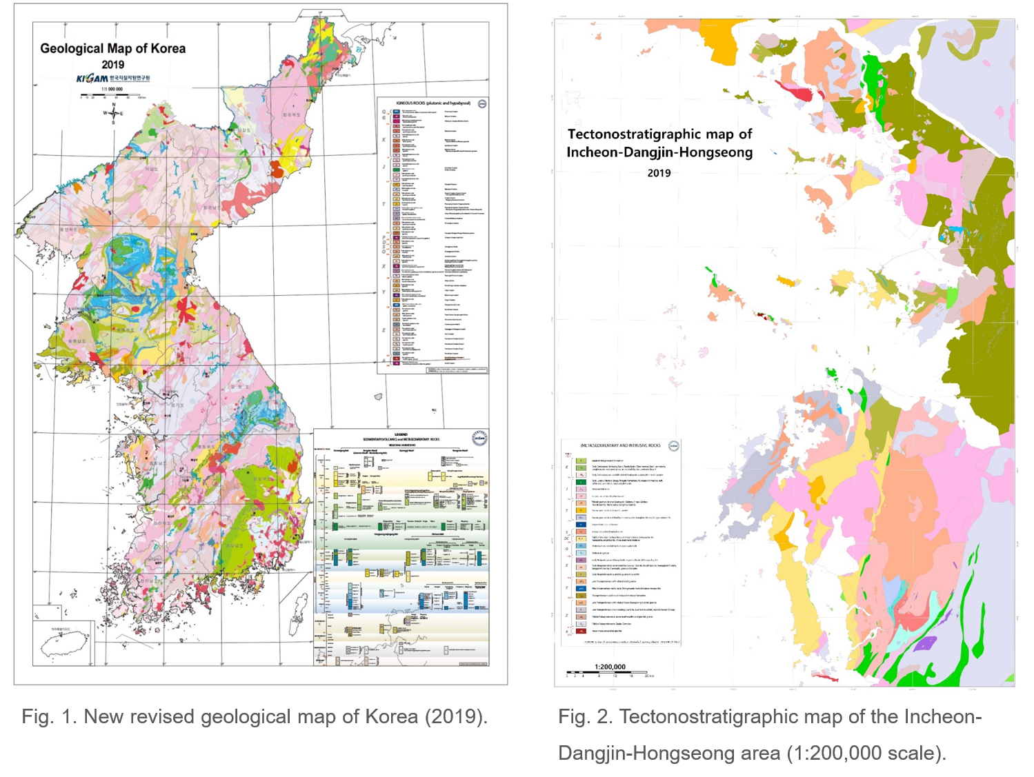
As the demand for new geologic maps of Korea with up-to-date geologic information has increased from the geological community, revised edition of the Geological Map of Korea (1:1,000,000) and new Tectonostratigraphic Map of the Midwestern coastal area of the Korean Peninsula (1:200,000) were published in 2019. The Geological Map of Korea (1:1,000,000) is a revised version of the distribution of Precambrian to Phanerozoic rocks on the Korean Peninsula based on a systematically classified legend incorporating all of new geological and stratigraphic information (Fig. 1).
The tectonostratigraphic map on a scale of 1:200,000 was also published integrating previously published three tectonostratigraphic maps (Hongseong, Dangjin-Daesan, and Gimpo-Incheon) from the western coastal area in the central Korean Peninsula in 2019 (Fig. 2). The western coastal area of the central Korean Peninsula preserves important evidence well, allowing us to reconstruct multistage tectonic histories during prolonged periods from the Precambrian to Phanerozoic. The integrated tectonostratigraphic map includes tectonic cartography as a base for understanding all processes that took place during the long geological history.
Contact: Sung Won Kim (sungwon@kigam.re.kr)