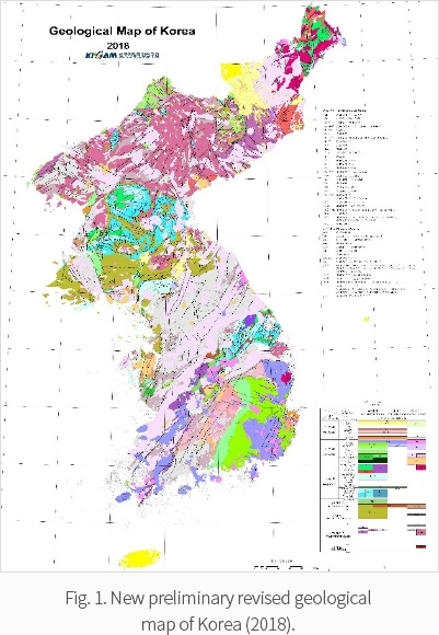
Since the last publication of the Geological Map of Korea (on a scale of 1:1,000,000) in 1995, considerable amounts of new geologic and stratigraphic information, largely based on high-quality age data, have been acquired. This necessitates a revision of the map reflecting the new findings and research on the geology of Korea. The new, revised edition of the Geological Map of Korea (1:1,000,000) is planned to be published in 2019. This year a revised preliminary version of the distribution of Precambrian to Phanerozoic rocks in the Korean Peninsula has been completed on the basis of a systematically classified legend to reflect all of the new geological information (Fig. 1).
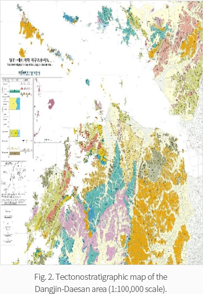
In addition to the revised geological map of Korea, a series of tectonostratigraphic maps of the western coastal areas of the central Korean Peninsula on a scale of 1:100,000 will be published owing to the geological and tectonic importance of these areas due to the occurrence of unusual high-pressure rocks, such as Meso- to Neoproterozoic supracrustal and intrusive types that are rarely found on the mainland. A tectonostratigraphic map of the Dangjin-Daesan area (1:100,000 scale) was published in 2018 (Fig. 2).