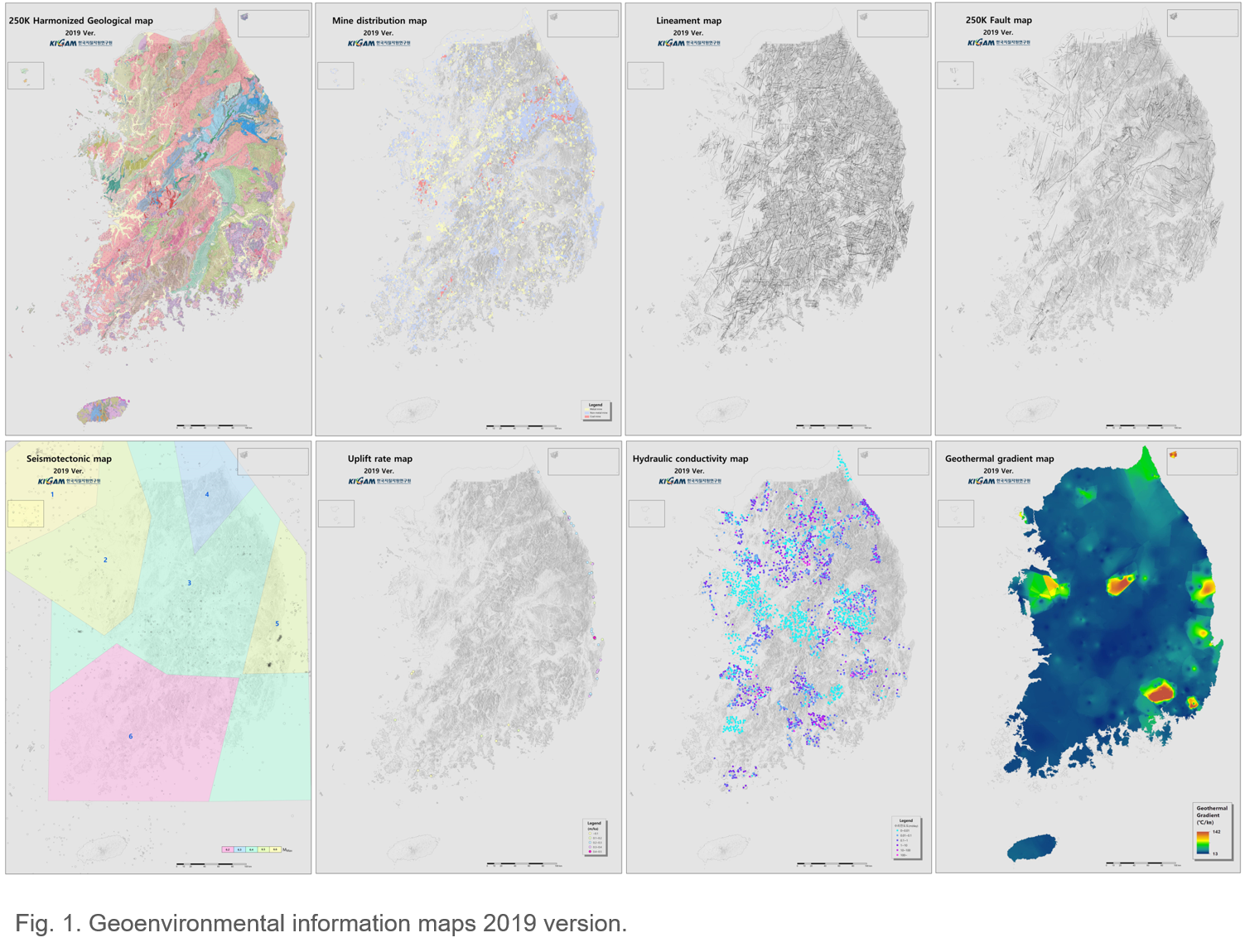
The Center for HLW Geological Disposal strives to provide transparent and reliable geoenvironmental data for geological disposal of HLW. In 2019, geoenvironmental information maps for eight evaluation items, including rock types, ore deposits, lineaments, faults, earthquakes, uplift, groundwater, and geothermal heat were manufactured, for use in the first stage of the HLW disposal site selection process (Fig. 1).
Firstly, existing geoenvironmental data were collected. Then, new data when the necessary data were not available were produced. After that, item-specific methods were developed and used to review process, and information on the eight items was verified. Finally, the 2019 versions of the eight geoenvironmental information maps were published. For example, for the rock type item, the nine 1:250k geological maps published before 2002 were integrated and harmonized. In the process, 47 mismatches in terms of geological boundaries, rock types, or geological age were found. Field investigations, rock sampling, microscopic analyses, and age dating were conducted to remove the mismatches and used to create a seamless, harmonized map. The geoenvironmental information maps will significantly contribute to HLW disposal site selection in Korea.
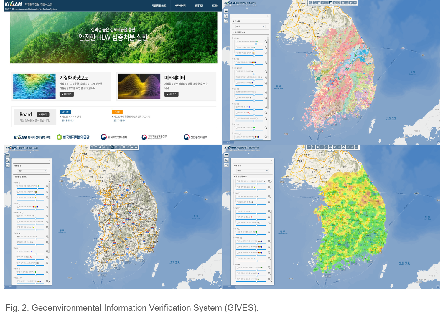
Secondly, the Geoenvironmental Information Verification System (GIVES) was developed, a platform to efficiently provide the above nationwide geoenvironmental information maps to the government, implementer, regulator, researchers, and public, using web GIS systems based on open-source software and the OGC/ISO open-space information standard (Fig. 2). GIVES will enhance the reliability of geoenvironmental data and strengthen transparency in their delivery. It will eventually contribute to mustering citizen support for HLW geological disposal in Korea.
Thirdly, the investigation/evaluation items and parameters were reviewed and a total of 17 items and 104 parameters were selected for use in evaluating potential sites in the different stages of a three-stage site selection process. Specific geoscientific investigation methods were recommended to obtain relevant parameter values.
Finally, preliminary tests were performed on rock-joint properties under various hydromechanical conditions and we participated in the MaCoTe project managed by Nagra at the Grimsel Test Site (GTS) in Switzerland.
Contact: You Hong Kihm (kihmyh@kigam.re.kr)