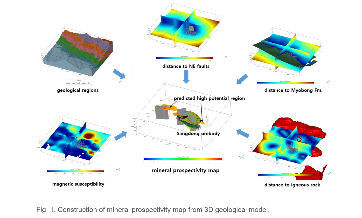
3D mineral prospectivity mapping for skarntype mineralized zone of Nokjeonri-Sangdong area was carried out, based on a 3D geological modeling platform and integration of exploration data from drilling, geological investigation (targeted for ore deposit), and airborne magnetic surveys. From the skarn mineral system concept, five exploration criteria (ore-controlling strata, distance to fault, distance to Myobong Formation, magnetic susceptibility, and distance to igneous rock) were generated from the 3D geological model; then, weights and scores for the exploration criteria were assigned using expert knowledge. The mineral prospectivity map was prepared using a multi-class index overlay method. The prospectivity map was validated using a known orebody; the success rate was 95%. The proposed approach will be a valuable guide for identification of new deposit-scale, deep-seated mineralized zones.
Contact: Chang Won Lee (cwlee@kigam.re.kr)