- Name담당자-MOU
- Date2021/11/26 00:00
- Hit446
How to Use Treasure Map of the Earth
The Geological Map filled with various colors contains so much information that it is not an exaggeration to call a treasure map in the field of geological resources. If you can read the geological map, it is possible to know what the rocks of the land that you are standing on, and more importantly in what era they were made.
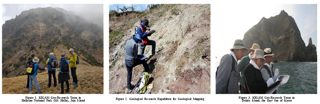
The Geological Maps are the ground foundation for Korea Institute of Geoscience and Mineral Resources (KIGAM). In this KIGAM R&D News with questionnaires, we shall find out the birth and history of the geological map, as well as how to read the geological map correctly. All national-level geological maps are opened to the public.
Q 1. What is a Geological Map?
A 1. A geological map refers to a drawing that shows the distribution of rocks, geological structures, and stratum conditions exposed on the surface of an area with colors, patterns, and symbol lines on the topographic map. Simply put, it contains information that can tell what kind of rock the land in the area you live in now.
Q 2. Where the geological information being used in the Geological Map?
A 2. The information contained in the geological map can be used in various fields. It is essential data for exploration of mineral resources such as coal and other mineral data, and also it is used for the basic data of constructing reservoirs for the agricultural irrigation as well as social infrastructures i.e. highway roads, railroads and port networks. It is also used to prevent landslides and to study soil distribution.
Q. 3 Who made the FIRST Geological Map?
A 3. The oldest geological map in human history was made around 1150 BC. The ancient Egyptian pharaoh, Ramses IV, built a large-scale temple, and the rocks and quarries used for it were recorded on the papyrus paper. This is the first geological map of mankind. The semi-modern geological map was published in 1771 for the Auvergne France, and contains information on erupted volcanic rocks and geological information of this region.
The first regional geological map, reflecting the first stratigraphic concept, was created by British geologist William Smith in 1815 as a British geological map in the book called, “Maps that Changed the World”. He worked as a registered surveyor, found out that the basic concept of stratigraphy which were the order of the strata buried with coals are constant.
In other words, he realized that it was a uniformly inclined strata in order was the same even on the surface of the earth, and that the age of the strata could be determined by analyzing the fossils from each strata in detail. William Smith spent a lot of time traveling all over England and completing the first geological maps of England.
He wanted to transmit three-dimensional information into a two-dimensional surface in order to produce a map that could see through invisible rocks of the ground. For this purpose, he used color index to indicate changes in the stratum and information. William Smith's geological maps were the basis for modern geological mapping.
Q 4. When was the modern-day Geological Map of Korea started?
A 4. The geological map of Korea was produced starting with the Joseon geological map (1:50,000 scale) during the Japanese colonial period. Japan created geological maps for the purpose of exploiting underground resources and building railways and canals for transporting war materials.
It was a painful history in making the geological maps, but they were used as the very important assets. It contains a variety of information, which is of great help in understanding the situation on the Korean Peninsula at the time, and in areas where geological maps have not yet been published, the Joseon geological maps are still being used. In 1956, Korean scholars published the first geological map of Korea (1:1000,000 scale).
Q 5. Where and how to make a Geological Map?
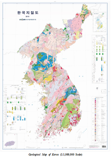
A 5. In the case of Korea, Korea Institute of Geoscience and Mineral Resources (KIGAM) is the only one organization producing a Geological Map. Geological Maps of various scales (1:2,500, 1:2,500,000 1:5,000,000 1:250,000, 1:1,000,000) are published depending on the usages.
The 'National Basic Geological Map' with a scale of 1:50,000 has been producing ongoingly for over 100 years since the early 1900s. Geological surveys are conducted by dividing the entire country into 359 regions for the geological mapping. Currently, 95% of the total area has been published, and 100% publication will be completed by 2025.
Q 6. Are there different types of Geological Maps?
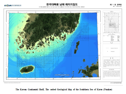
A 6. Recently, the Geological Maps based on comprehensive geological information, geological maps with various themes are produced accordingly to the purposes of use. We publish the Geological Map for Quarternary Period, hydrogeological map, coal geological map, and tectonic structure map, as well as seabed geological maps that can be used for marine resource exploration.
In 2020, KIGAM started to publish a Geological Map with a scale of 1:100,000 will contain new environmental geological information such as heavy metals, radioactive substances, and harmful substances to the human body.
Q 7. Where can I see the Geological Map?
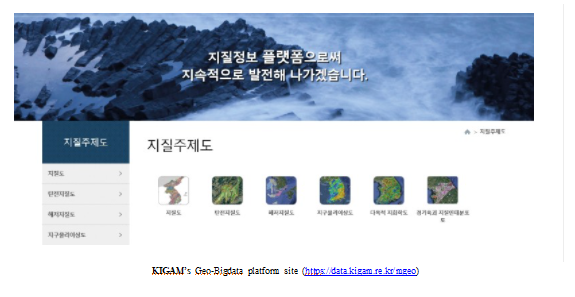
A. KIGAM opens all digitalized research data, including geological maps and geological information through the Geo-Bigdata platform site (https://data.kigam.re.kr/mgeo) to the public for free. You can access 3D-based Geological Maps, seabed geology maps, geophysical maps, and geothermal maps.
For More Information:
Dr. Kim, Sung Won (sungwon@kigam.re.kr)
Head, Geological Research Center
Geology Division
Korea Institute of Geoscience and Mineral Resources