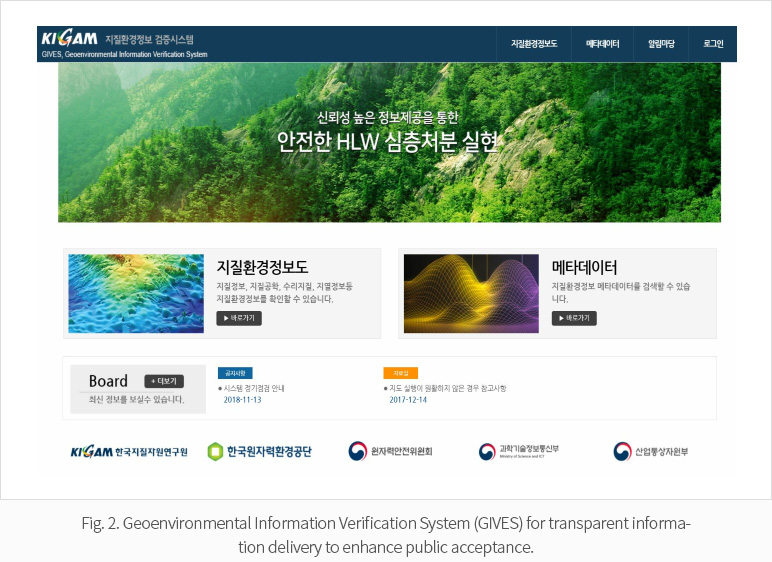
Public acceptance is one of the keys to the selection of a successful site for high-level radioactive waste (HLW) disposal. We are developing the Geoenvironmental Information Verification System (GIVES) to provide reliable nationwide geoenvironmental thematic maps for the government and for implementers, regulators, and researchers in HLW disposal related fields as well as for the public. The GIVES would contribute to gaining more support for HLW disposal by enhancing the reliability of geoenvironmental data and strengthening transparency with regard to data delivery.
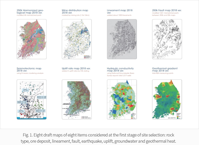
In developing the GIVES, we grouped the geological aspects relevant to the first stage of site selection into the eight items of rock types, ore deposits, lineaments, faults, earthquakes, uplift, groundwater, and geothermal heat. We have developed a draft map for each of the eight items
For example, the rock type is one of the most important factors when selecting a repository site for HLW. We are conducting integration and harmonization of 1:250k geological maps published before 2002. We found that 48 areas in total have mismatches in terms of geological boundaries, rock types, and/or geological age.
We have solved these problems and created a draft of a harmonized map by conducting field investigations, rock sampling, microscopic analyses, and age dating (Fig. 1).
Lineament distribution is another important item. For verification of existing lineament data, we applied the Finnish lineament classification to existing lineament maps and compared the lineament data with fault traces on the 1:250k geological maps. We created a draft of the 1:250k lineament map based on 1:250k satellite images after reflecting the opinions of experts in related fields with various academic backgrounds and expertise (Fig. 1).
We developed the GIVES using web GIS systems based on open-source software and the OGC/ISO open-space information standard (Fig. 2). The GIVES has been evolving through the upgrading of the standard map management methods, the geological environmental information history management function, the web security authentication function based on the first-year prototype system, and through improvements of the user interface.