GEOLOGICAL SURVEY OF KOREAN PENINSULA AND PUBLICATION OF GEOLOGIC MAPS |
Geological surveying and mapping (1:50,000 scale) of the Korean Peninsula has typically been one of the fundamental missions of KIGAM, and geologic maps of Taedo·Ganseodo· Manjaedo· Gageodo sheets were the latest results of the project in 2020 (Fig. 1). In addition, a newly standardized 1:100,000 scale geologic mapping project will begin in 2021, and 1:500,000 scale tectonostratigraphic map of the central part of the Korean Peninsula project is expected for completion in 2024. We also developed and utilized KMapper (Fig. 2), a digital geological survey system, that can record locality information, photographs, structural measurements, and other data collected during geological survey processes. KIGAM will maintain updating the system, and wider distribution of the system to potential users is planned.
Contact: Sung Won Kim (sungwon@kigam.re.kr)
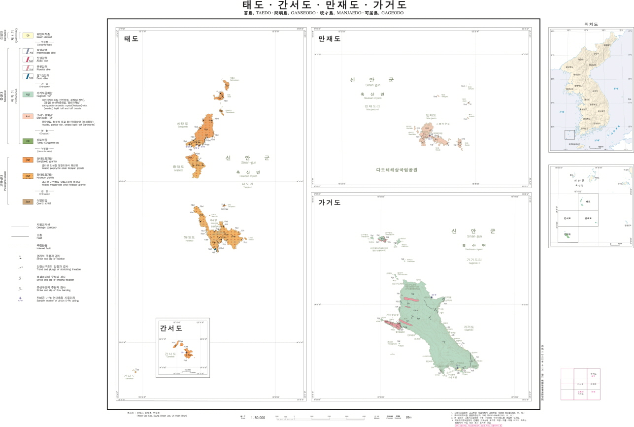
Fig. 1. Geologic maps of Taedo·Ganseodo· Manjaedo· Gageodo sheets (2020).
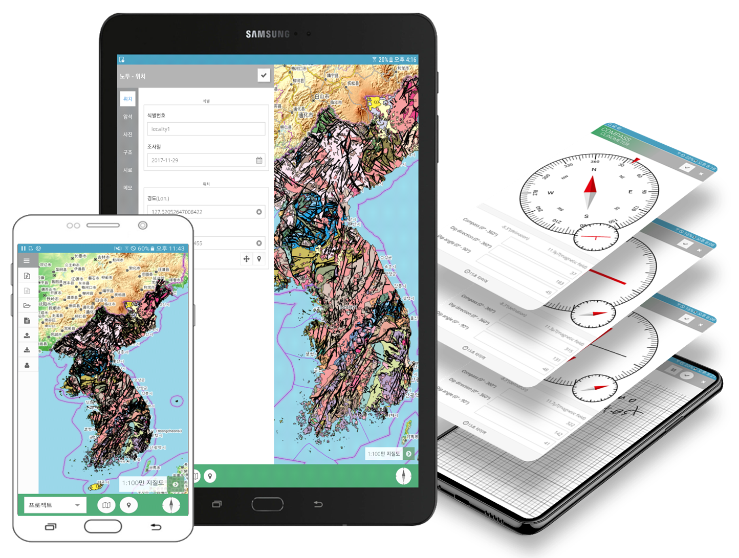
Fig. 2. KMapper; digital field geological survey system.